
Delivering quality construction solutions for modern living and sustainable developments.
Precision meets expertise. Led by Er. Somasundaram Sakthivel, we offer topographic, boundary, and layout surveys, leveling & contouring, and DGPS/GNSS solutions for large-scale infrastructure projects, ensuring accuracy from planning to execution.
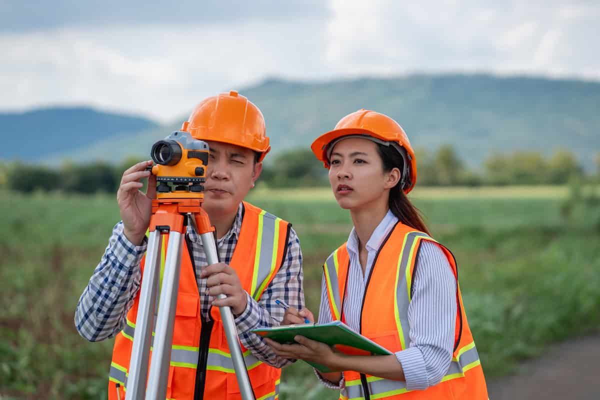


At EROSOMAS, we specialize in precise land surveying, boundary and layout planning, leveling, and contour mapping. Our solutions for railways, roads, airports, and townships ensure accurate construction marking and reliable project execution.
To deliver accurate, reliable, and technology-driven surveying solutions that support infrastructure development with the highest standards of quality.
To become a trusted and leading surveying organization by adopting advanced technologies and consistently exceeding client expectations.
We are committed to timely delivery, precise data, and strict quality control through skilled professionals and disciplined execution.
We are a real estate firm with over 20 years of expertise, and our main goal is to provide amazing locations to our partners and clients.

Initial site visit to understand project scope, survey type, terrain conditions, control points, and client requirements. Suitable survey methodology and instruments are finalized.
Step - 01

Accurate field measurements using Total Station, DGPS / GNSS and advanced digital instruments. Data is collected for boundaries, levels, alignments, structures, and terrain features.
Step - 02

Survey data is processed into AutoCAD drawings, contour maps, and finalized reports for execution and approvals. Survey data is converted into accurate AutoCAD drawings and final deliverables.
Step - 03
We specialize in end-to-end digital land surveying services with a strong focus on precision, compliance, and practical execution. From topographic and boundary surveys to DGPS mapping and AutoCAD documentation, our expertise supports infrastructure, construction, and large-scale land development projects.


“EROSOMAS Digital Land Survey provided accurate boundary and land survey services for our property. Their measurements were precise, documentation was clear, and the entire process was handled professionally.”
“We relied on EROSOMAS for layout survey and planning support for our development project. Their survey data was reliable and helped us avoid costly errors during execution.”
“The topographic and leveling survey conducted by EROSOMAS was detailed and accurate. Their professionalism and timely delivery made our construction planning much easier.”